


GeoCodis participated in a humanitarian project aimed at strengthening crisis resilience and empowering women in South Sudan. The project was implemented between 2023 and 2025 by Slovenian Caritas in cooperation with Caritas South Sudan. It addresses the consequences of conflict, climate crisis, and poverty. Support includes food and water security, women’s empowerment, and protection of vulnerable groups.
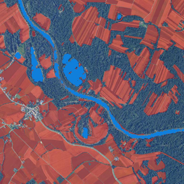
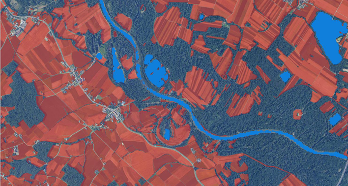
As part of the project, GeoCodis developed a QGIS plugin for monitoring droughts, floods, deforestation, and other environmental changes. It uses various indices derived from satellite imagery. In doing so, the company contributed to the transfer of knowledge and technology to a developing country and supported efforts to increase the resilience of local communities to environmental challenges.
The plugin, called South Sudan Monitoring, allows users to visualize different indices for selected areas of interest and time periods. This helps improve monitoring and preparedness for natural disasters and deforestation. It uses vegetation, water, and drought indices based on Sentinel-2 satellite images with a spatial resolution of 10 to 30 meters. The tool was built for the open-source QGIS platform, which is also available in South Sudan.
One of the key features of the plugin is the ability to manually define areas of interest, allowing for more precise temporal and spatial analysis, even in remote or hard-to-reach locations.
Partners: Caritas Slovenia, Caritas South Sudan
Funding: Republic of Slovenia, Ministry of Foregin and European Affairs RS
