


Satellite Detection Algorithms for Wetlands (SDA4Wetlands)
Wetlands (ranging from marshes and bogs to floodplains and coastal lagoons) are among the most biodiverse and ecologically valuable ecosystems on Earth. They provide essential services for people, wildlife, and natural processes. Yet, despite their significance, wetlands are among the most threatened ecosystems globally.
To address this issue, GeoCodis took a leading role in the SDA4Wetlands project, funded by the European Space Agency (ESA), in close collaboration with KappaZeta Ltd. (Estonia) and EOLAS Insight Ltd. (Scotland). Through the application of advanced remote sensing technologies, the project aimed to enhance the detection and monitoring of wetlands.
Project Goals
- Identify, test, and validate satellite-based algorithms for wetland detection and monitoring.
- Application of remote sensing methods to enable cost-effective, rapid, and technologically advanced wetland monitoring.
Project Workflow
Understanding User Needs: At the outset, we conducted a thorough analysis of existing data, legislation, and literature. In parallel, we gathered insights through a targeted survey among organisations involved in wetland conservation. The findings revealed a strong demand for high-quality, accessible wetland data, both in Slovenia and internationally.
Selecting Monitoring Indicators: Based on the research and stakeholders feedback, we identified key indicators for monitoring wetland health, each representing a measurable aspect of wetland status. These indicators were classified as project requirements.
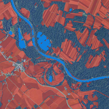
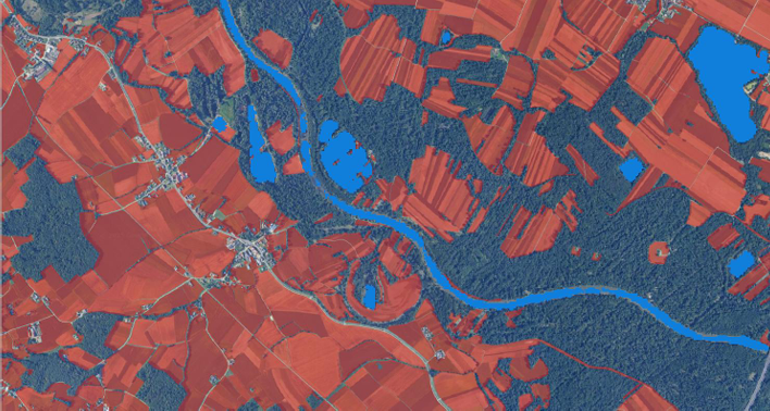
Choosing the Right Tools: We selected Sentinel-1 and Sentinel-2 satellite imagery as the foundation for algorithm implementation. Each algorithm was tailored to detect specific wetland indicators and aligned with project goals.
Testing Across Diverse Regions: Algorithms were tested and validated in multiple pilot areas across Europe (Slovenia, Scotland, and Estonia) and the East African region (Uganda, South Sudan, and Ethiopia). Algorithms were tested by the ability to monitor predefined project requirements. The overall performance of the algorithms was strong in both regions, demonstrating their robustness across different climatic and environmental conditions.
Evaluation and Validation: All algorithms were scored against predefined criteria and assessed for their suitability to monitor specific indicators. Results were compiled into a comparative evaluation matrix, helping to identify strengths, limitations, and opportunities for further refinement.
Looking Ahead: The project yielded promising results, with each algorithm successfully monitoring at least one key indicator. A significant finding throughout the study was that the algorithms are complementary, offering greater insight when used in combination, as each contributes distinct and valuable information. This demonstrates the potential of remote sensing-based tools in supporting wetland conservation efforts. SDA4Wetlands establishes a strong foundation for future advancements, including the development of an application aimed at delivering high-quality data to conservation practitioners, policymakers, and researchers.

