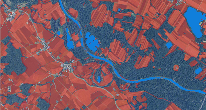
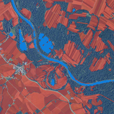
Analysis of flooding in selected areas in Slovenia (2015-2024)
Execution of a public procurement contract by the Ministry of Agriculture, Forestry, and Food (MKGP)
Execution of a public procurement contract by the Ministry of Agriculture, Forestry, and Food (MKGP)

EO-based service that provides independent, spatially explicit, corroborative evidence to support ESG claims verification

Humanitarian project in South Sudan for monitoring environmental changes (floods, droughts, deforestation …)
")
Project for wetlands detection and monitoring, using remote sensing and artificial intelligence.

Platform based on satellite data for space observation in Kario, for the revitalization and development of the city.

Upgrading the UPMIS water management information system in Uganda.

Project for satellite-based assessment of the impact of water spread weirs on landscape.


The overall goal of the CEOIS project is to assist the geo-spatial unit of the World Bank.

GeoCodis and Space SI are working together to provide services for receiving up-to-date satellite images, for the detection and analysis of water surfaces and flood areas, and to provide the right information for users.