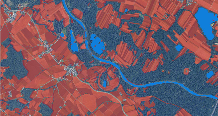
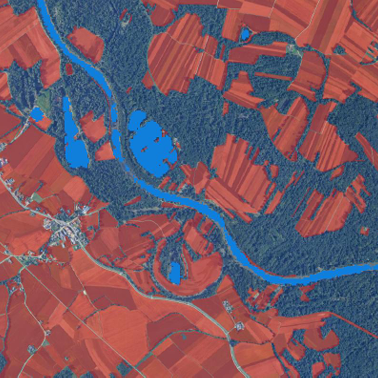
Analysis of flooding in selected areas in Slovenia (2015-2024)
Execution of a public procurement contract by the Ministry of Agriculture, Forestry, and Food (MKGP)

Our team has extensive experience in Earth Observation, having contributed to numerous projects that harness satellite data for environmental monitoring and analysis. We excel in transforming raw geospatial data into actionable insights, supporting critical decision-making processes across various domains.
We offer consultations and specific trainings to customers who need to integrate AI, Earth observation analyses or GIS into their business processes.
Our solutions help businesses to develop a competitive advantage by developing custom end-user applications, providing consulting, information technology and services for better understanding and analysing spatially distributed business data.
We integrate different data sources and provide added value to public and customer’s data. Quality information and spatial structures is essential to support our clients and critical business needs.
Execution of a public procurement contract by the Ministry of Agriculture, Forestry, and Food (MKGP)

EO-based service that provides independent, spatially explicit, corroborative evidence to support ESG claims verification

DROUGHTWATCH
Web application for monitoring and forecasting drought within the Clim4Cast project

Humanitarian project in South Sudan for monitoring environmental changes (floods, droughts, deforestation …)
Smart innovation that addresses the challenges of efficient management of irrigation systems. The HidroSmart system enables real-time target irrigation tailored to heterogeneous landscapes with satellite imaginary.
")
Project for wetlands detection and monitoring, using remote sensing and artificial intelligence.

Platform based on satellite data for space observation in Kario, for the revitalization and development of the city.

Upgrading the UPMIS water management information system in Uganda.


Project for satellite-based assessment of the impact of water spread weirs on landscape.
In recent years, we have been dealing with the processing of satellite data. Using developed algorithms and machine learning, we detect changes in space, such as the appearance of water, settlements, forest etc…


