GeoCodis carried out a public procurement contract for the Ministry of Agriculture, Forestry and Food (referred to as MKGP), entitled “Analysis of selected areas with constraints for agricultural activity due to frequent flooding and analysis of the entire territory of Slovenia over a selected time period in relation to land flooding.” To ensure a systematic approach and implementation, the analyses were divided into two main thematic sections.
- Analysis of selected areas with limited potential for agricultural activity due to frequent flooding
- Analysis of the territory of Slovenia during the selected period due to land flooding
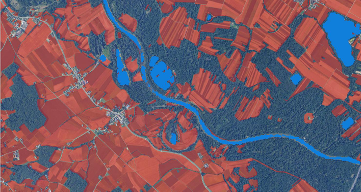
Data on detected water surfaces used in both analyses were sourced from the VodaKje.si application, which has been systematically collecting and analysing detected surface water across Slovenia since 2014. The application relies on a surface water detection algorithm based on Sentinel-1 SAR (Synthetic Aperture Radar) data, as described in the scientific literature (Oštir, Rak, Tovšak, 2016).
It is important to note that the methodology identifies the presence of water on the surface (water-body detection) without differentiating between types of water bodies, such as floods, standing or flowing water, or temporarily accumulated rainwater. The term “flood” is therefore used in a broader sense, referring to any area where water presence has been detected.
Oštir, K., Rak, G., Tovšak, J., 2016. Radar Satellite Imagery and Automatic Detection of Water Bodies. Geodetski glasnik 50(47), 5-15. DOI: 10.58817/2233-1786.2016.50.47.5
The results of the analyses were validated using independent sources:
- Optical satellite imagery (Sentinel-2, Landsat 8 and 9)
- Measurements from weather stations (ARSO archive)
- Meteoinfo, radar image archive (ARSO)
- Hydrological measurements (ARSO archive)
- Media, photographs, social media posts
First part of the analysis
The analysis was conducted over a 10-year period, from 2015 through 2024. To avoid issues related to snow cover, we used data from the April 1st to November 30th for each calendar year.
Selected areas of analysis (9):
- Planinsko polje
- Radensko polje
- Ljubljana marsh
- Pivka intermmiten lakes
- Cerkniško polje
- Dolnjevaško polje
- Zadloško polje
- Dobrepolje
- Ponikve
Two methodological approaches were used: we analysed and compared annual maximum flood events, and we analysed where floods occur at least twice or at least four times over a 10-year period.


Second part of the analysis
Analysing the presence and extent of water on agricultural land during a selected period (20 days prior to 15th of November, every year). For the purposes of the analysis, specific categories of agricultural land use were selected from the MKGP Land Use 2025 source and combined into a single agricultural land area. The maximum detected water surface area on agricultural land (in %) at the municipal level was considered. The results were visualized in the form of simple maps, based on the category of water coverage (in %).


